As we left the hotel we were shocked to see rain. It rains here? Weird. Not to worry, we had a couple hours to drive and we were confident that the rain would be long gone by the time we arrived at the Grand Canyon. Headed up the road we stopped in Flagstaff and grabbed some food and snacks for the day.
We took an alternate route into the park, and as we rolled in to the park about 8 a.m. we shocked as there was no ranger working the admission gate and the massive parking lots had less than 5 cars in them. I guess our plan worked....
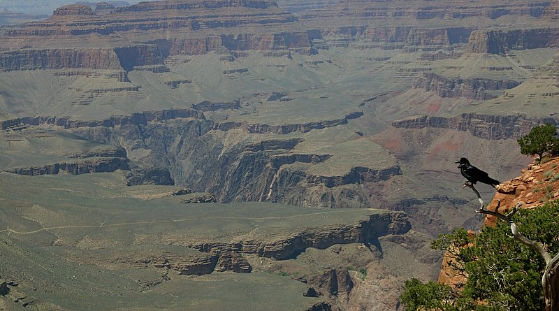
We started on the very east side of the canyon, and spent some time gawking at the enormity of it all. We explored the observation tower with its multiple levels of overlooks. Jill & I both agree the views from above the canyon were superior to those offered by standing at the overlooks on the rim.
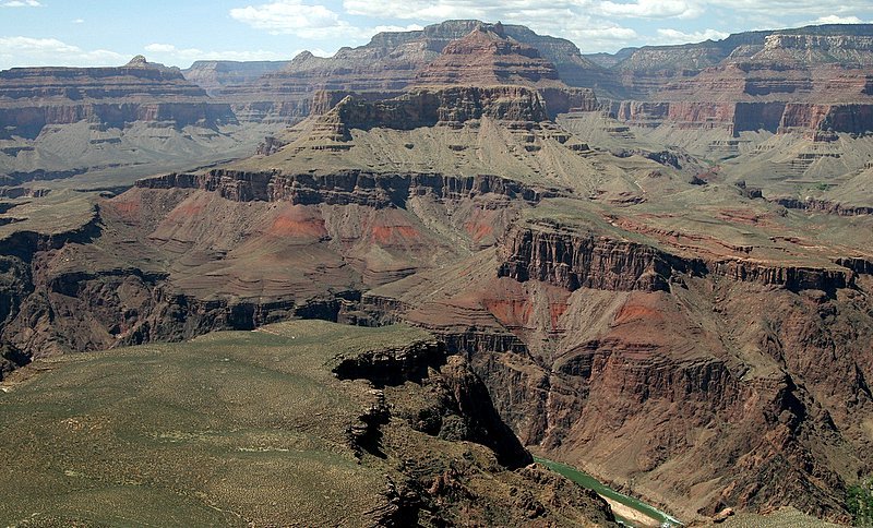
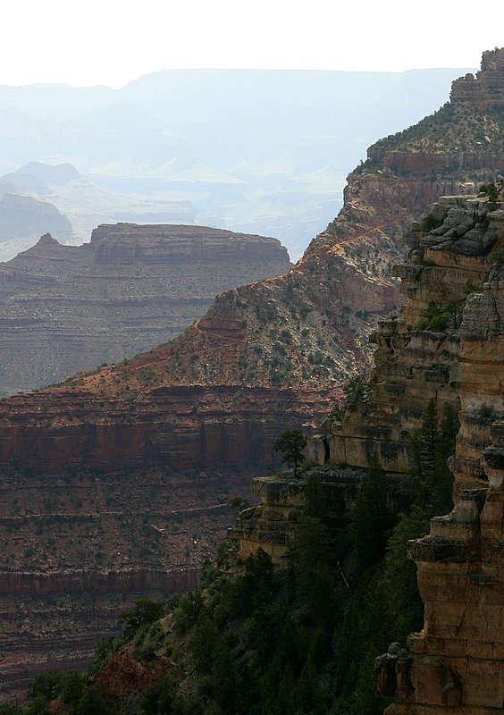
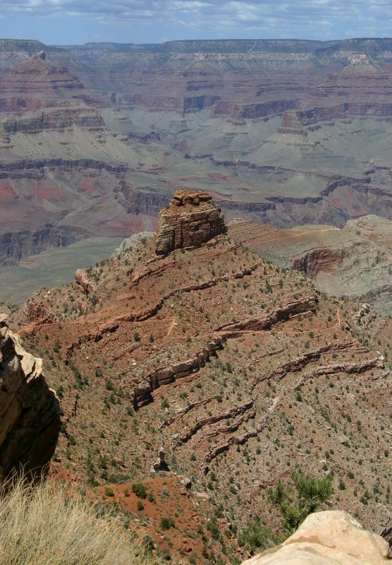
We began driving our way west in the park, stopping at lots of overlooks and admiring the views. We eventually worked our way to the center of activity in the park, where all the hotels and services are stationed. We hopped on a bus so we could take in the Hermit Road views where only park busses are allowed to travel. The overlooks got better and better as you went west on Hermit Road. At one point I looked over and saw a trail etched into a ridge that jutted out into the canyon. What I didn't realize at that point was the trail we were looking at was the Kaibab Trail, a trail that we would become very familiar with later in the day.
After doing our touristy tour of the canyon, we set off to do something a little more gonzo. After all tour busses aren't exactly our style....
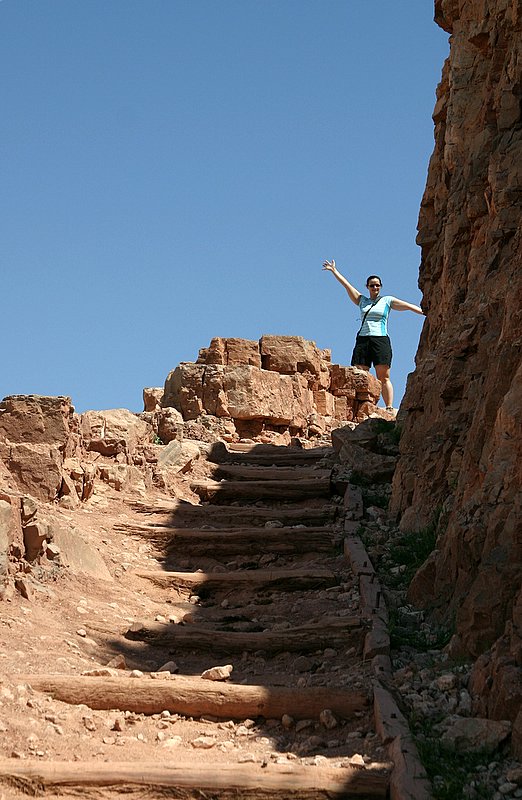
Jill made some sandwiches up as I drove back east towards the Kaibab trailhead. We snarfed up a couple sandwiches each, drank as much Gatorade as our bladders could hold and filled up our Camelbak to the brim with water. Upon arriving at the trailhead we made note of the distances and time to allow for the two major points on the trail. I scoffed at the thought that a 3 mile hike should allow 2-4 hours or the thought of spending 4-6 hours on a 6 mile hike. "Who are these people? Well they are obviously not as tuff as we are" I thought as we started our sheer plummet on the Kaibab Trail.

Looking in the faces of the people suffering their way back to the top as we descended I realized this was going to be a bit tougher than initially expected. The trail was steep and powdery dry, with many sections were the "steps" were about two feet differences in elevation. We kept chugging along making pretty quick work of the descent into Cedar Ridge, the turn around point for the 2-4 hour hike. As we arrived I looked at my watch and found we made it in just under 30 minutes which I was pretty pleased with considering we yielded to lots of uphill hikers along the way.
At Cedar Ridge we had a big decision to make, we could continue down the trail to Skeleton Point or turn around and head back to the top. We debated about the merits of the two but I finally decided that we needed to "live a little" and we headed out. I was under the impression that the CO River was near Skeleton Point and I'd get to cross the suspension bridge, but later I would find out that my main motivation for continuing was under false pretenses. Oops.
Once we got to Skeleton Point we were rewarded with our first view of the Colorado river. We could barely make out the campsites below as we were still several thousand feet above in elevation. We stopped and took in the scenery at Skeleton Point while I gave Jill a pep talk about our plan of attack to get ourselves out of the canyon. We are now sitting a full 3 miles and more importantly 2,000 vertical feet below the rim of the canyon. The route back is a punishing series of steeps steps that switchback on the ledges overlooking the canyon.
As we started our death march back to the top I tried to make sure Jill was drinking plenty of water as the exposed trail gave way to the heat of the day. We powered out the climb back to Cedar Ridge, but Jill started to hit a wall as we approached. We stopped at Cedar Ridge, ate a couple candy bars and then started the trek again. The bad news was the trail we were starting up now was the steepest part and we had already expended a significant amount of energy just getting to Cedar Ridge. Maybe those recommendations actually meant something....Huh.
Jill dug down deep and I tried to help keep her mind off the enduring pain as we trudged up the final climbs of the day. We took rest stops in any shady spot we could and I tried to conserve the water as much as possible. I've run out of water on death marches like these before and that is the point where it gets really ruff, so I hoped to conserve enough to get us both back to the top as there was no other option.
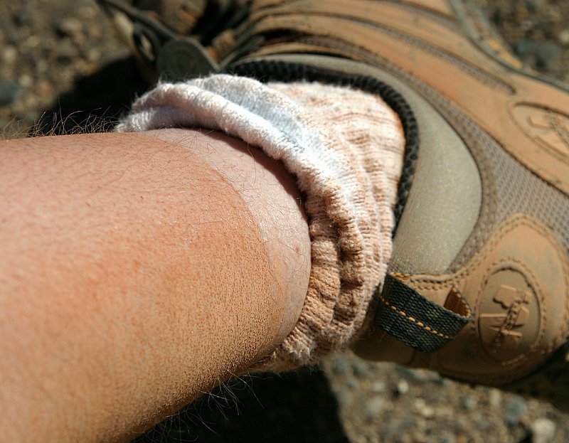
Finally we saw the final set of switchbacks and slowly made our way up the final climb and to the trailhead. We weren't the only weary hikers to be glad to be done with the climb, as there were about 15 of us who climbed the whole route together exchanging pleasantries as we past, but upon reaching the parking lot very few words were spoken. I couldn't resist taking a picture of my "trail tan" that I got, couldn't wait to get to the shower back in Sedona.
I was really glad we did the hike, and happy that we continued although I think its going to take some time before Jill feels the same way. I pushed her probably a bit too hard coming back up trying to get her to not concentrate on the daunting task as a whole but merely a series of smaller steps. A cool hike IMO.
1 comment:
Ah, yes, I giggled out loud when I read your account of underestimating the times suggested to climb into and out of the GC. I was a victim of this thinking as well once, many years ago, sadly more than I would like to count, but I was a teenager with a competetive father and brother and was not about to be left behind as they decided to hike Bright Angel Trail. I can say is the descent was pleasant. The ascent, well, I prayed that the day I die it would not be as painful and unpleasant as that ascent, on a very steep and very dusty trail on a very hot July day slowly running out of water...... A once in a lifetime experience for me, literally! I guess I can say I am glad you experienced the hike because it is a truely beautiful and unique view from the trail elevations. You got some great pictures and it looks like it was an extremely enjoyable trip, although I can't believe 5 years has passed already! Congratulations!
Post a Comment